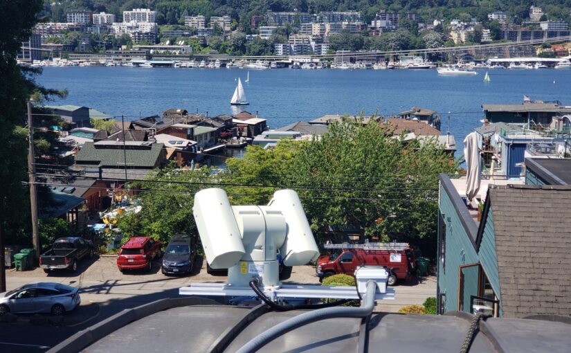
I had a lot of fun installing an industrial outdoor pan-tilt-zoom (PTZ) camera on my roof in Seattle. Whereas most townhouses built today have rooftop decks, my townhouse has a curved metal roof. Being near Lake Union, it has a phenomenal view from the top of the roof, showing the city, the lake, and even Gasworks park. Since it’s pretty difficult and unsafe to get up on that roof, I did the next best thing, which was to install a camera. This was inspired by this skybot cam post.
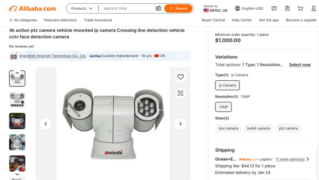
I spent a lot of time looking at camera options. New cameras from US vendors seem to be roughly $30k, which was way out of range. So I checked alibaba. Sure enough, there was a pretty awesome looking one with 4K resolution.
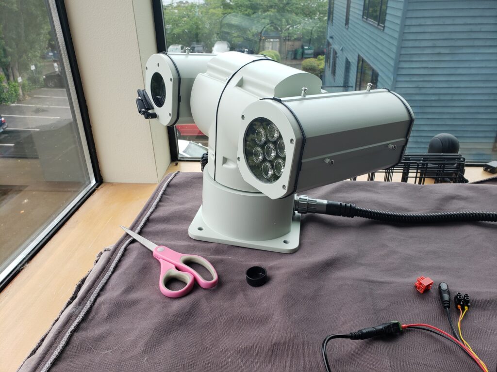
I was a little skeptical of how it would turn out, but was pleasantly surprised with the build quality and reliability. It showed up pretty quickly and I tested it out.
Getting into the firmware took a second because the password on the sticker was misspelled. I was able to figure it out and get in. The firmware was pretty solid with lots of cool features, and the camera supports basic ONVIF stuff so I can control it with standardized software, e.g. in Home Assistant via Frigate.
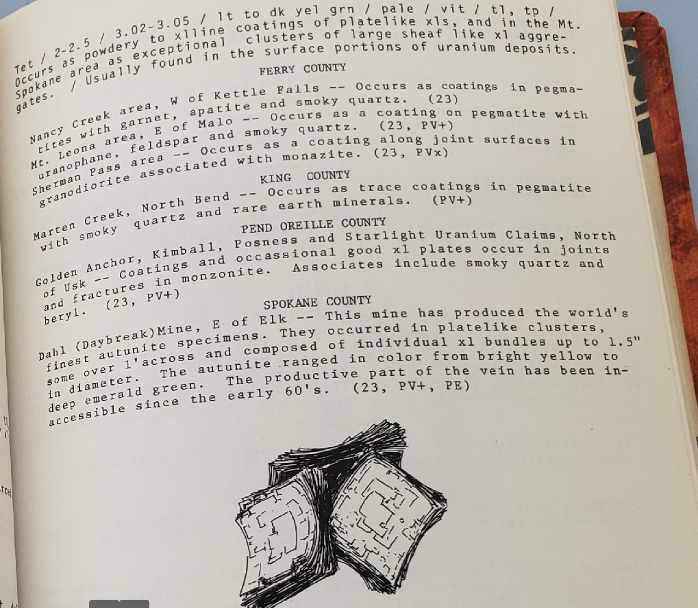
Autunite is a beautiful and rare uranium mineral that’s common in Spokane, WA. That’s a four-hour drive from my home in Seattle. However, in the 1975 out-of-print book “Minerals of Washington” by Bart Cannon, there is brief and ambiguous mention of some closer to Seattle in King County!
Minerals of Washington, by Bart Cannon
Marten Creek, eh? This one sentence appears to be the sole reference for this mindat entry, which appears to just be a random dot along the creek.
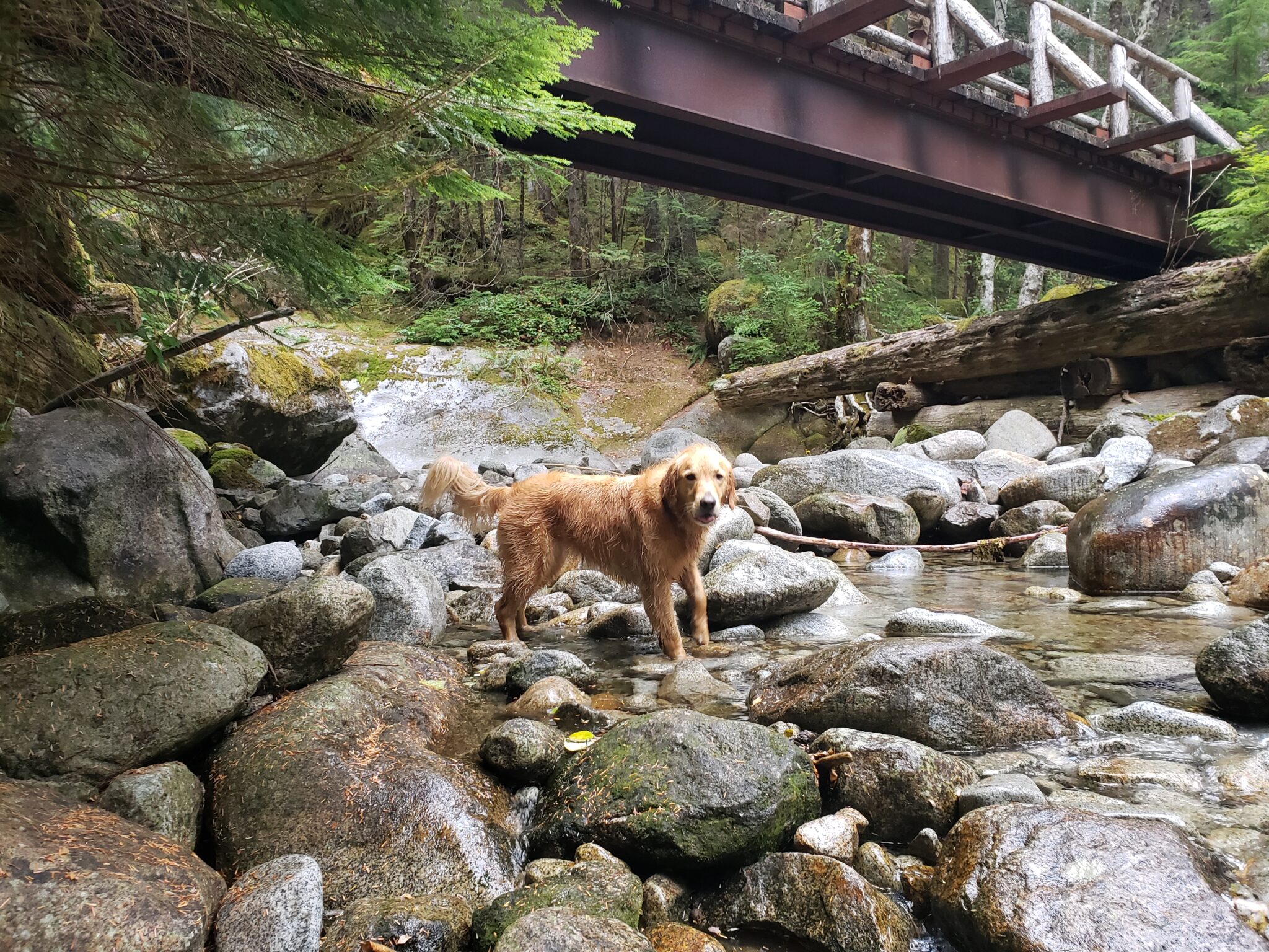
Middle Fork road is totally paved these days, so there’s just about 0.5 miles of gravel at the end. Very easy access. The hike starts out as a walk on the road, and then a nice, fairly flat trail for 2.7 miles. The turn-off on the left to Marten Lake is not labeled, but you know you went too far if you get to a beautiful bridge about 2.7 miles in.
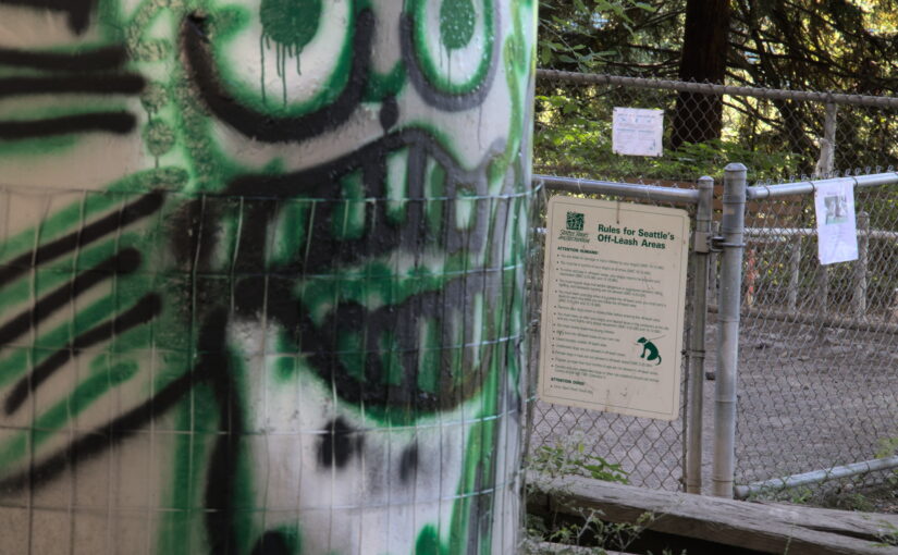
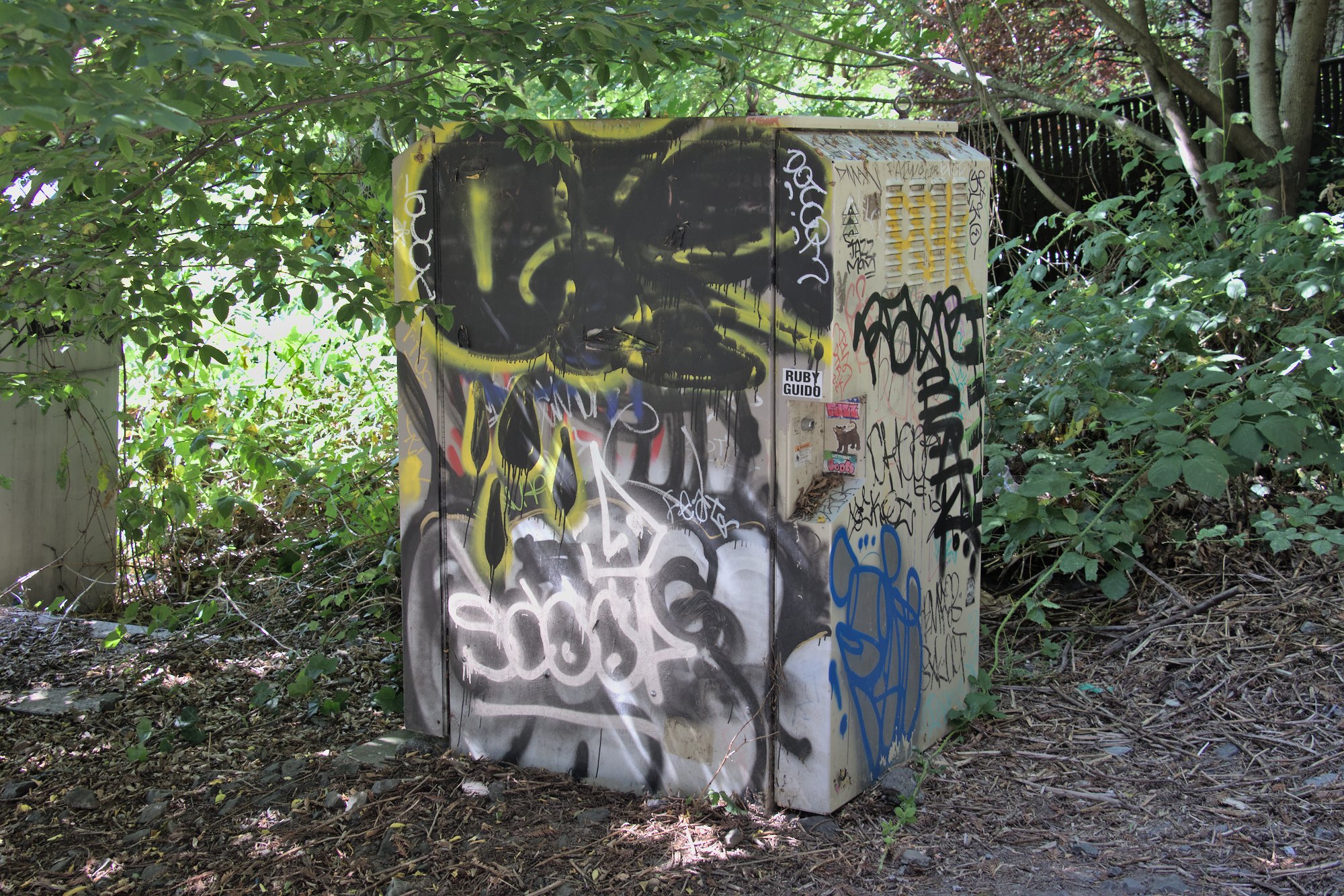
There’s a dog park under the I-5 interstate in Seattle’s Eastlake neighborhood. It’s here on a map. Many dog lovers hate it. It’s been called sketchy, dystopian, horrifying, and so on. But it’s not all bad. This post describes it a bit.
Entering from the Eastlake side, at Franklin and Blaine
As you’re entering you’ll see a bit of graffiti, ripped up Amazon boxes, and assorted garbage. This has come and gone over the last few years but is fairly common today.
Art
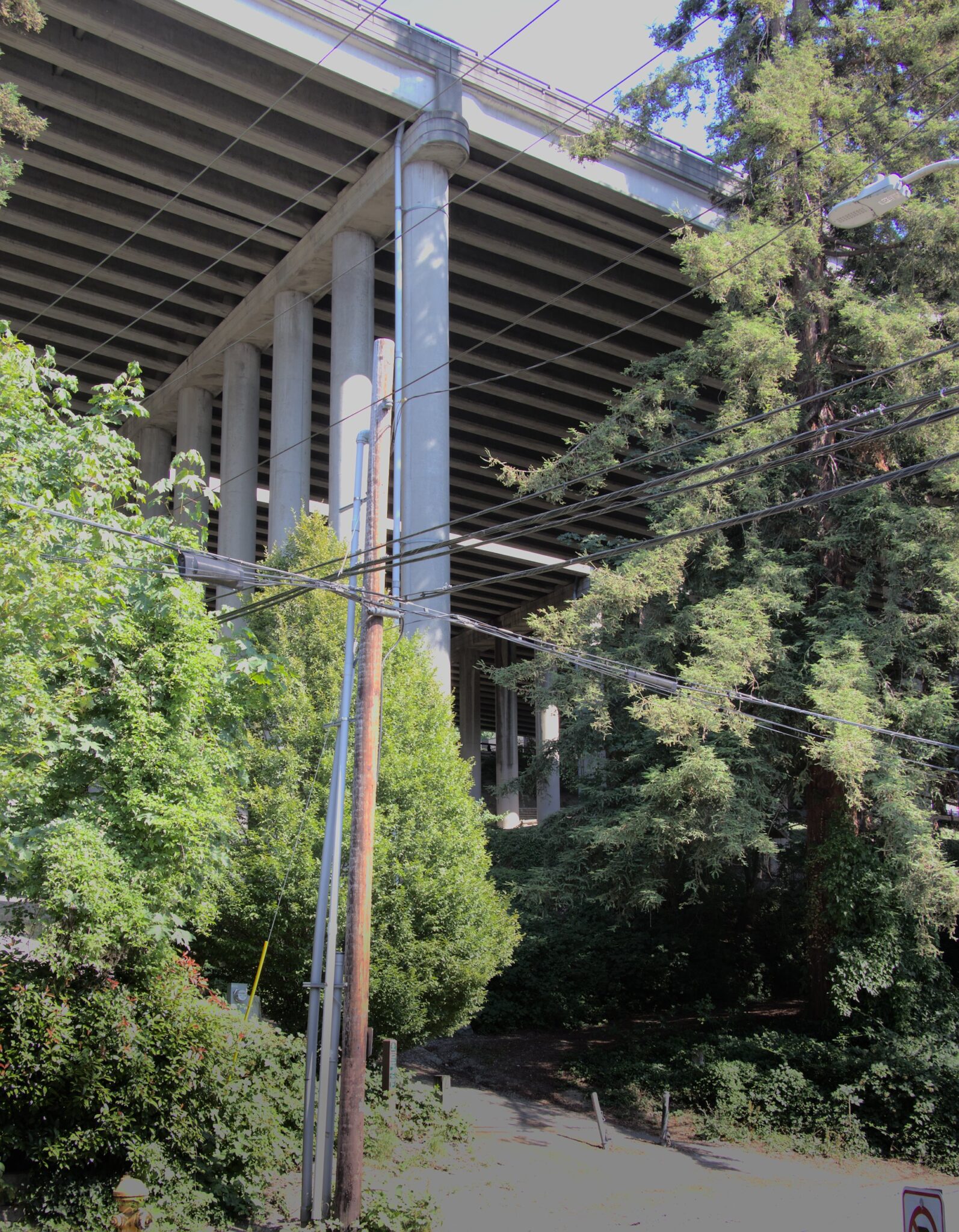
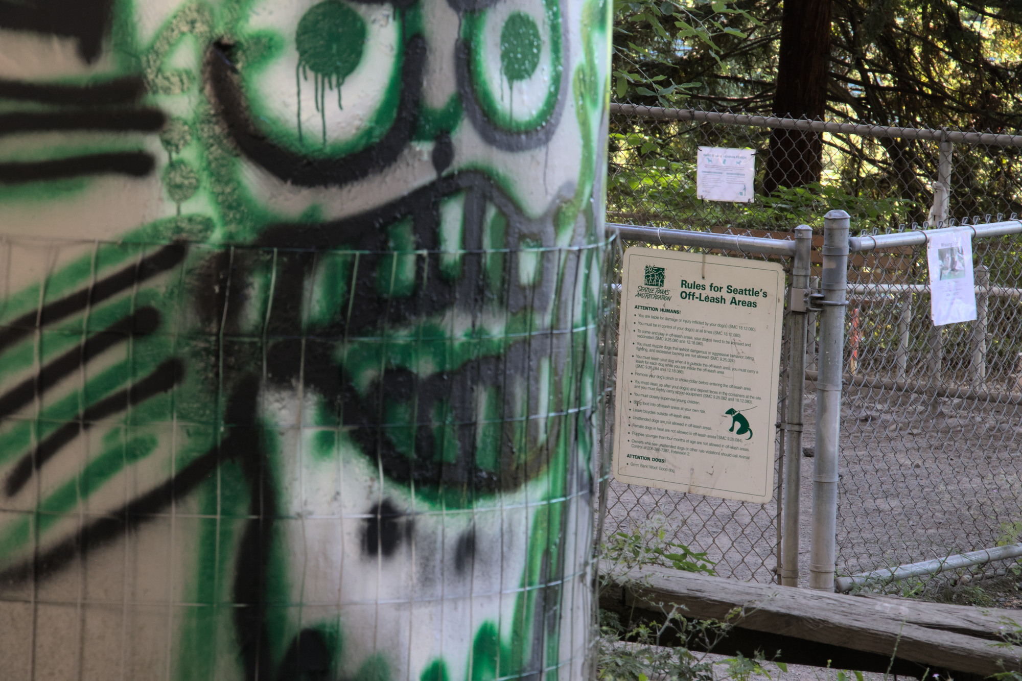
After a brief climb, you’ll find the entrance
The north entrance to the dog park
It has a gravel surface that gets a bit dusty, and it’s also fully covered by I-5. So it does stay dry in the rain!
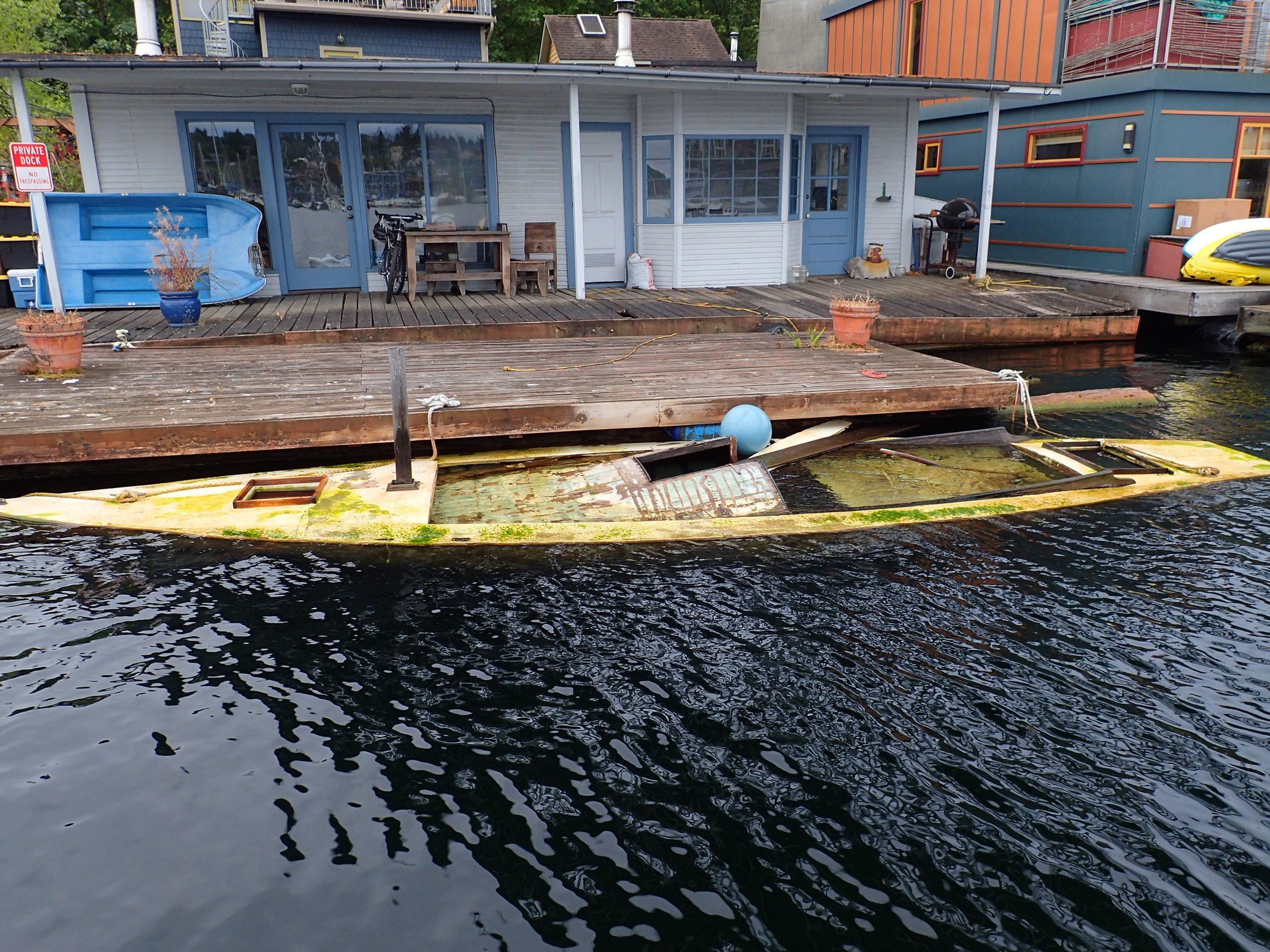
Today I accomplished my big summer goal of paddleboarding from Lake Union in Seattle to the Puget Sound and back. This is my story.
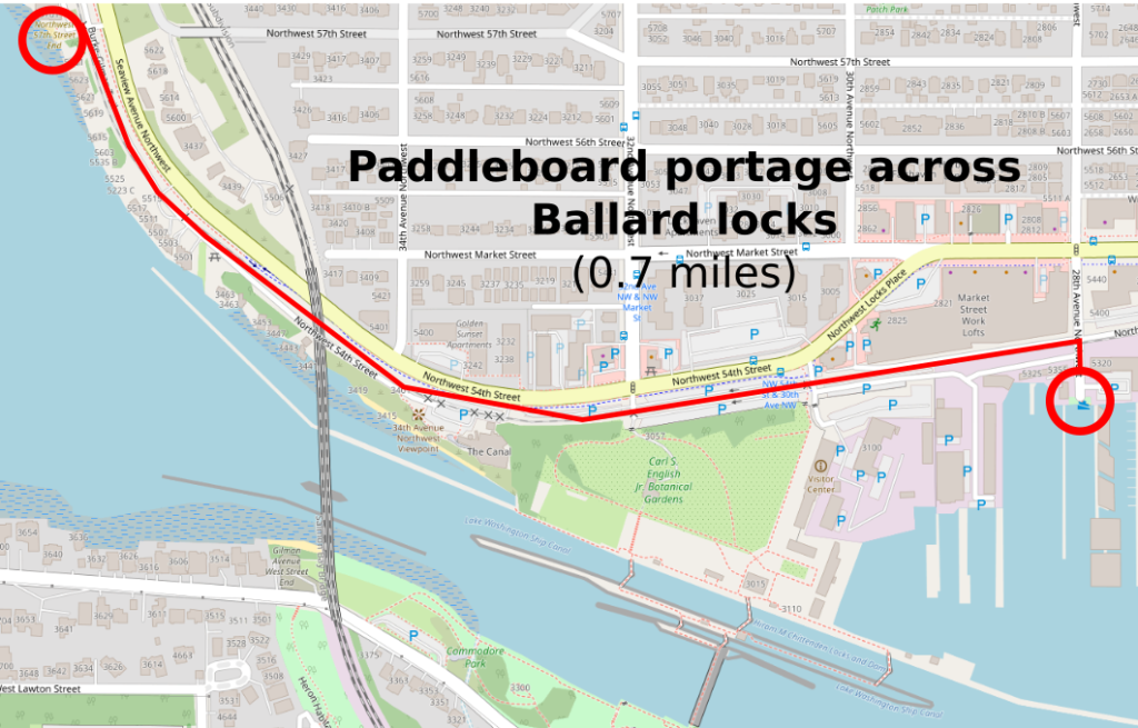
Paddleboards cannot go through the locks
I’ve seen kayaks go through the locks but never paddleboards. Upon looking into it, I was able to confirm that paddleboards are not allowed in the Chittenden (Ballard) locks. So I got out a map to look for ways around the locks. I found a little street end park at 28th Ave NW and figured one of the various public shores to the north would have beach access. I was hoping it would be the first few, but they are on pretty significant bluffs. So I found that the best re-launch spot is a full 0.7 miles down the road, at the NW 57th St. beach.
Portage around the Ballard Locks for paddle boarders. It’s a bit of a hike (0.7 miles), but not too long. You can grab a burger or ice cream along the way for a break 😎
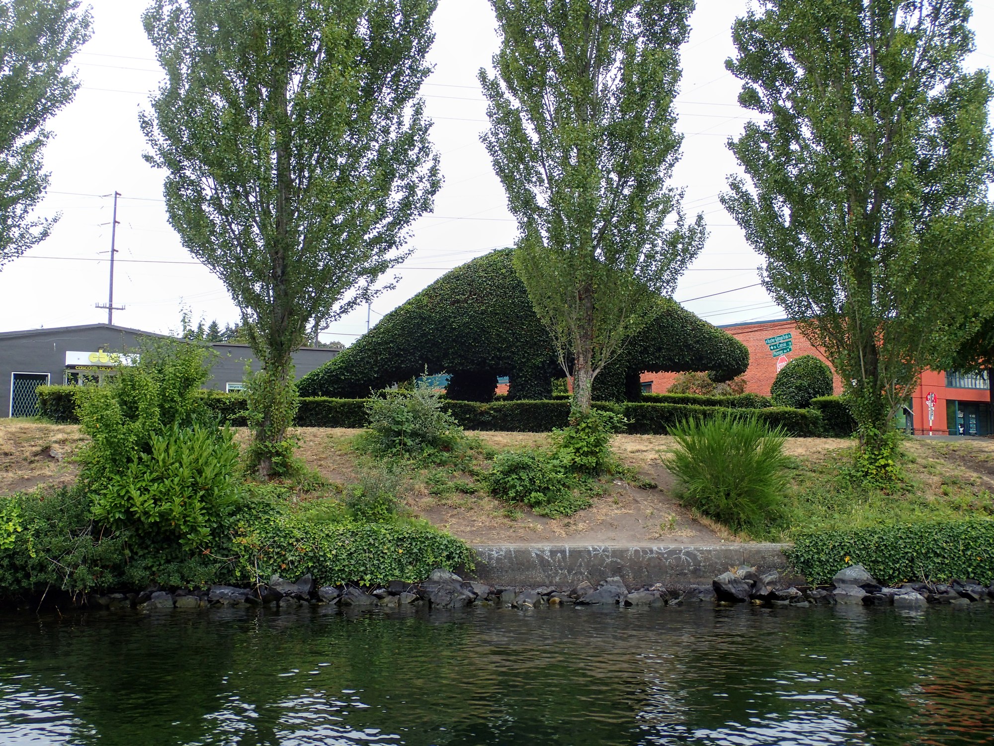
Photo Journey
The wind forecast for today was really calm and that’s what I had been waiting for. This kind of journey would be too hard for me if I had to fight strong winds in one direction or the other. I left around 8:30am.
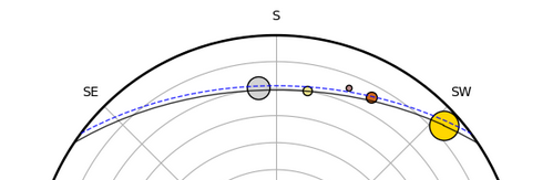
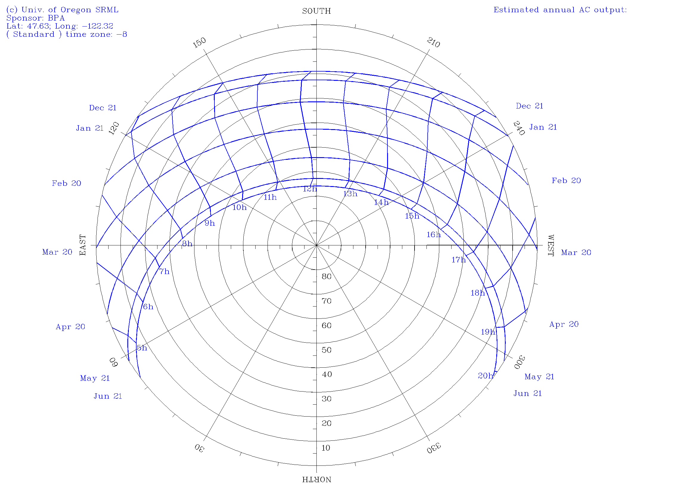
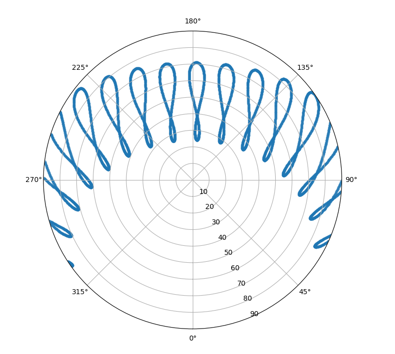
I happened upon a polar sun path chart a while back and really thought it was a great graphic. It shows where the sun goes each day as a function of the seasons. Behold:
The polar Sun path chart for Seattle, WA
For Seattle, you can see at the top that the sun rises in the SE, peaks at 20° above the horizon, and then sets at 4:30pm on the winter solstice. Ugh. But in the summer, it’s up from before 4am to after 8pm, and peaks above 60° . You can make one of these plots for your area over at the University of Oregon’s Solar Radiation Monitoring Lab.
I liked this plot so much that I wanted to take it to the next level and see where the sun is live. In my experience with Python, I’ve grown to expect there to be sweet libraries that can compute stuff like that. Sure enough, there are a few. First, I found pysolar, which is really straightforward, fast, and simple. A few lines of code and I was up and running.
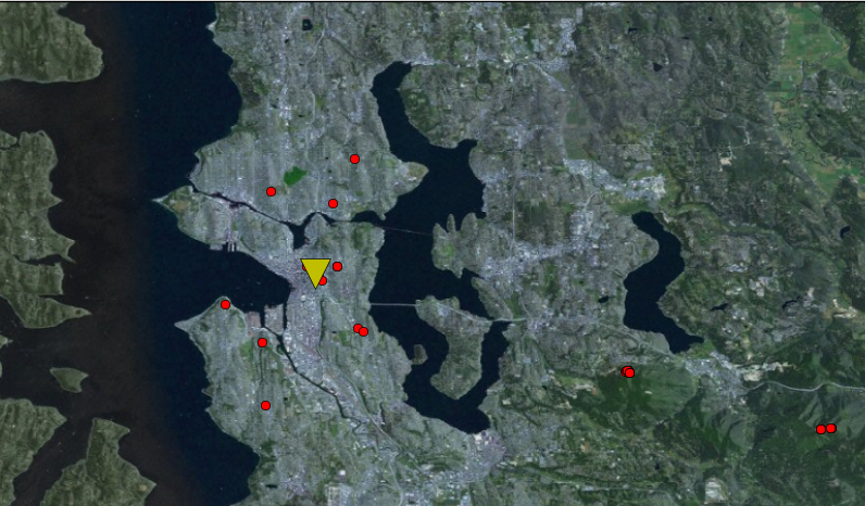
In this post, we’ll take a brief measurement of regular old FM radio stations and try to determine where we are. It’s like a GPS but with local FM transmitters instead of satellites. I did this just for fun. I wonder if it could be used for indoor location and stuff? It is nowhere near as accurate as GPS. But whatever.
Reading FM radio signal power
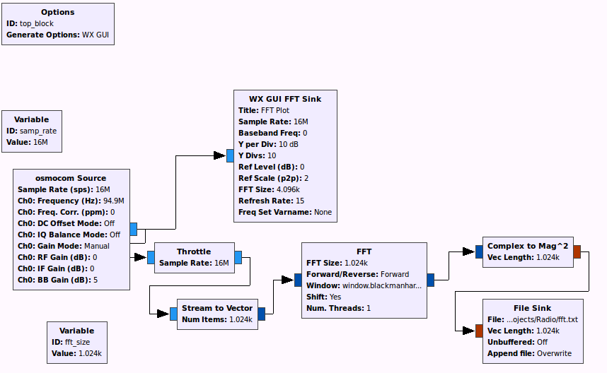
The first step is to get a reading of all the nearby radio stations. I used gnuradio and a HackRF One software defined radio. A simple flow-chart that takes the FFT and dumps it to a file is all I needed. I had to throttle the I/O or else my computer would freeze. I used 16M sample rate to have as wide a bandwidth as possible.
The gnuradio flow-chart used to gather data
The file sink saves the FFT results in 4-byte integers and just has one 1024-length vector after the other. In a few seconds, I had a 50 MB of data. I did all the post-processing in an external Python script.
At Smashputt 2012 last night, there was a random old Schwinn exercise bike like my mom use to have. I made Kylie and Caroline ride it like my sister and I used to: one person on each pedal!
Awesome bike. It even had the dinger!
Here’s a really dark video that kind of shows how much fun it was
But it was worth a try. Maybe the road has been fixed by now. About that:
Yeah, it's not going to be easy to drive over that
So we drove to a different nearby hike (5 miles or so).
Lake Serene/Bridal Veil Falls Hike
The first 2 miles are a gradual climb on nice trail. That gets you to the Bridal Veil falls, which are very nice. The next two miles are a tough climb. Tough for me at least. All the other people there were carrying babies or small dogs. On the way back down, Rachel and I had enough energy to go the 0.5 miles up to the upper falls, which were worth it.
Rachel at lower bridal falls
Bad pic of lake serene and mt. index
The lake was really beautiful. I scrambled around on the snow, of course. That was last weekend. This weekend, we did:
Monte Cristo and Poodle Dog Pass
Mostly because I wanted to find another way down to Mineral City, we decided to try the monte cristo hike. This time, Robert came along. Since this hike is supposed to have a boring and bikable first 4 miles, we loaded bikes into and onto my jeep and headed out to the Mountain Loop highway. We heard from a ranger that the 1st mile was going to involve us carrying our bikes a lot. He was right. We had to cross a log over the river and get over lots of cables holding the logs in place.
cross the logs
Then the road was a little bumpy for a while, with quite a few trees in the road. Good mountain bikers can get through the rocks, but we were walking for a while. Still, having bikes made the trip to monte cristo fairly painless. Going back down was exceptionally fast. Once in Monte Cristo, we had some lunch and checked out the working train turn table, while scanning the mountains for mines.
lunch at monte cristo
robert on the railway turntable
We didn’t see any mines, so we hiked up about 2000 ft. to Poodle Dog Pass. It was a nice hike that took probably 2 hours. Up there we saw lots of snow.
Robert, Rachel, and I up on poodle dog pass
Crystal lake had these incredible water falls coming down from snow-melt. It was breathtaking.
Rachel and the waterfalls above crystal lake
On the way down, we got to see what branches look like from the inside of a tree:
this is what branches look like from the inside
We biked out of there and ate dinner at a Thai place on capitol hill. This whole big-city-right-next-to-mountains thing is nice.
What is there to do near Seattle? Well I’ll make a running list, since I have unlimited publishing rights on this, the website of me. I’ve been here for 2 weeks really and haven’t done as much as I should have. I’ve been busy. But I have found at least three really sweet places on the Eastside.
#1: Denny Park. Wow. It was day 1 and I was just walking through my neighborhood when I found this little street. There’s a trailhead there that descends into deep old-growth, fern-covered forest. As I hiked down, it got prettier and prettier. I got to the bottom to find large moss-covered trees hanging over a stream. I walked for about a mile and found myself at Lake Washington. Hadn’t seen a single person until then. Great suburban hike.
#2: Marymoor Park. Huge park near Redmond. The thing that brings me here often is the free rock-climbing structure. I go there on way home from work occasionally to miss the traffic and boulder around. You can lead-climb here too. It’s actually really cool. It’s made of concrete and rock so it actually feels pretty authentic. There are also RC planes flying nearby every day if you’re into that.
#3: St. Edwards State Park. Ok enough with the state parks already. This one has ~12 miles of fun mountain bike trails. I went on them one morning to check it out and had a great time. There are even some jumps and stuff. Good forest views.
#4: Random lookout. This little pad has a sweet view. You can see Rainier if you go to the far left on a clear day. Good view of gas works park too. Enough to inspire me to go check that out, which was also cool.
Restaurants:
Virginia Inn – Ate outside. Slow service, but I wasn’t in a hurry. The food was good. How’s that for a review?
Thai joint by the AMC in Pacific Place – Mmmmm Thai food. Delicious. Good for before a movie.
Hector’s – mmmm. Fun atmosphere. Got big dinner and bottle of wine to hear some really weird story here. Loved it.
What the Pho? – Pho is in. It’s the new sushi. They heat up meat in broth, where it cooks. Get the well done stuff though as the rare is like, really rare. It was good but not quite as good as sushi. It’s pronounced “fuh,” by the way.
I also had more Thai and conveyor belt sushi and some other stuff but nothing really blew my mind as much as these, as described above.